Discover Flagstaff’s Mountain Bike Trails Less Traveled
It’s summer. It’s hot. It’s too hot to ride. “Let’s head up to Flagstaff and ride in the cool pines! We’ll ride Schultz Creek Trail… again.”

Although Schultz Creek is a great ride, there are far more opportunities to ride mountain bikes in Flagstaff, many of which are arguably much more fun and scenic, and far less traveled, than Schultz Creek Trail.
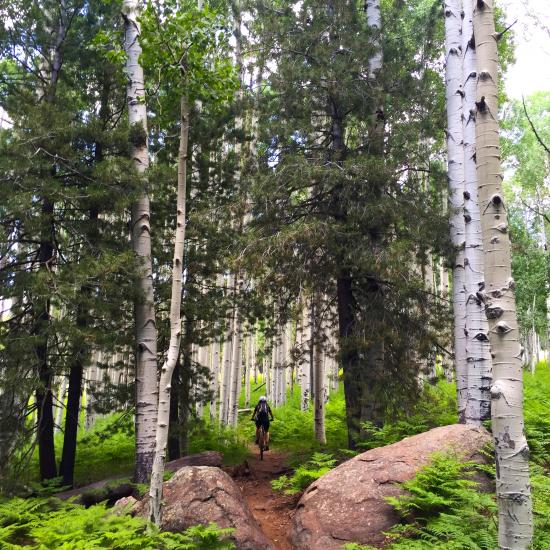
Ride (mostly) downhill from Arizona Snowbowl back to town.
This ride is a solid day of intermediate challenge with one of the longest descents in Arizona. You’ll need a way to shuttle bikes and riders up to the Humphreys Trail parking lot at the top of Snowbowl Road. This route features panoramic views at the top, mixed conifer and aspen forests, and finishes up in the ponderosas.
Head out on Humphreys Trail and stay left on Aspen Nature Loop. Once you reach Arizona National Scenic Trail (ANST) turn left. You’ll follow the ANST all the way to Schultz Creek Trail. If you shuttled from downtown, you can cross Fort Valley Road and hop on the Flagstaff Urban Trail System’s Karen Cooper Trail, and cruise past the Museum of Northern Arizona, along the Rio de Flag, back to town.
Do an epic enduro loop on the newly revamped Heart Trail.
The Heart Trail, previously used almost exclusively by a few hearty hikers, has had a major renovation and is fast becoming one of the favored trails in the region. It explores the remarkable geology and landscape of the east side of Mount Elden for a truly unique opportunity. Count on taking water and snacks and making an epic loop incorporating this route.
Combine this route as a climb with a descent through Sunset Trail’s “Hobbits Forest”, or climb Elden Lookout Road and send it down Heart Trail and then connect back with various combinations of Little Elden Trail, (also recently improved), Little Bear, Brookbank, Sunset and Schultz Creek trails to complete a loop from the Schultz Creek Trail Head area.
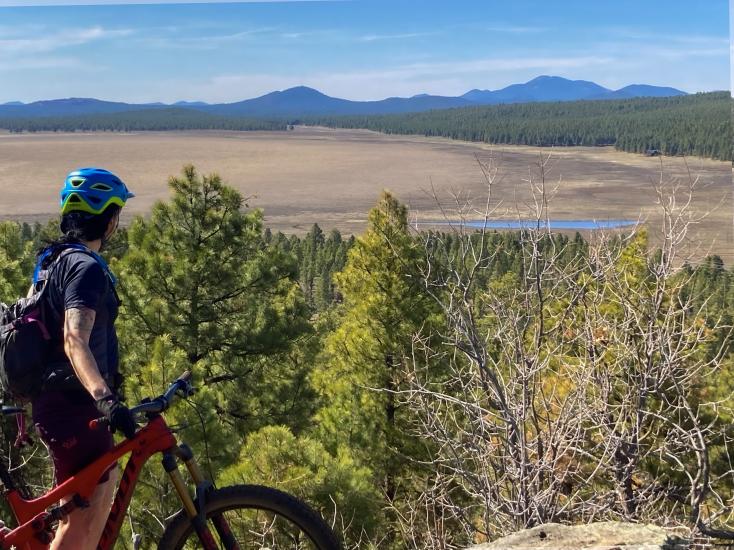
Explore the Rogers Lake area and check out the Fort Tuthill Bike Park.
Flagstaff is known for its challenging rocky trails, but there are some great routes that will appeal to folks who prefer less technical, fast, flowy single track. This ride is great for fit riders who are looking for a solid ride.
Start at Fort Tuthill Bike Park, where you can warm up on the pump tracks and flow trails. Travel around Soldiers Trail to find the Flagstaff Loop Trail heading west. Shortly after, you’ll turn left onto Rogers Lake Connector trail to head southwest.
Once you top out on Woody Mountain, you’ll “T” into the top of the Gold Digger Loop. This loop is a fun ride in either direction and ultimately, you’ll return the way you came. At the bottom of the descent of Gold Digger the Two-Spot Trail option will take you out to the mostly dry Rogers Lake and some great wildlife viewing opportunities.
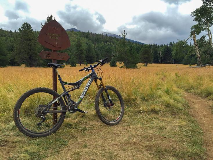
Cruise through the aspens on a trail for the whole family.
Although this option is a bit remote, this section of the Arizona National Scenic Trail is easy, on mostly smooth packed dirt, through beautiful aspen groves and mixed conifers. Since it is an out-and-back that gradually climbs on the way out, it’s easy to decide when it’s time to turn around and cruise back to the trailhead.
Drive north on Highway 180 toward the Grand Canyon. You’ll be turning right on FR 151, 12.1 miles past Snowbowl Road. (This is the second entrance to FR 151 that you’ll encounter.) Drive for 1.6 miles on this gravel road. Turn left onto FR 418 and travel 1.2 miles to the informal parking where the Arizona National Scenic Trail crosses the road. Most passenger cars should be able to negotiate the 2.8 miles of dirt.
You’ll be heading south on the single track through a huge stand of aspens. A good turnaround spot, if everyone is feeling strong, is at the Arizona Trail sign where the ANST intersects with the Bismarck Lake Trail. More adventurous riders can choose to climb to Aspen Nature Loop just below Arizona Snowbowl, or make a loop with the Bismarck Lake Trail, although the descent back to the trailhead the way you came is much better.
Weather, safety, and trail etiquette.
Summer weather in Flagstaff is mostly beautiful with temperatures in the 80s and sunny days. However, afternoon thunderstorms are common between mid-July and mid-September.
Most trails start at around 7,000 feet above sea level and increase from there, so be aware elevation may affect you and requires preparedness. Be sure to bring a map, cell phone, rain jacket, a basic toolkit, pump, plenty of water and snacks. Let someone else know where you are headed, especially if riding alone.
There are links to Trailforks maps provided above, but these are best paired with a good hard copy. Pick up Emmitt Barks Cartography’s Flagstaff Trails Map, and consider downloading the Avenza Maps version to your device as well.
Most of the trails suggested here are less traveled, but you are apt to encounter other trail users at some point. Please keep things friendly! Slow down or stop, say hello and abide by best practices for trail etiquette.
About the Author

Anthony Quintile
Anthony Quintile has worked in the bike industry for 30 years as a bicycle messenger, professional mechanic, bike shop manager, and event promoter in Flagstaff, AZ and Moab, UT. For the past two decades, he has been a Board Member and Trail Program Coordinator for Flagstaff Biking Organization and has led the development of the Fort Tuthill Bike Park and numerous volunteer and funded trail maintenance and construction projects.